
1. Beartooth Highway, Montana and Wyoming
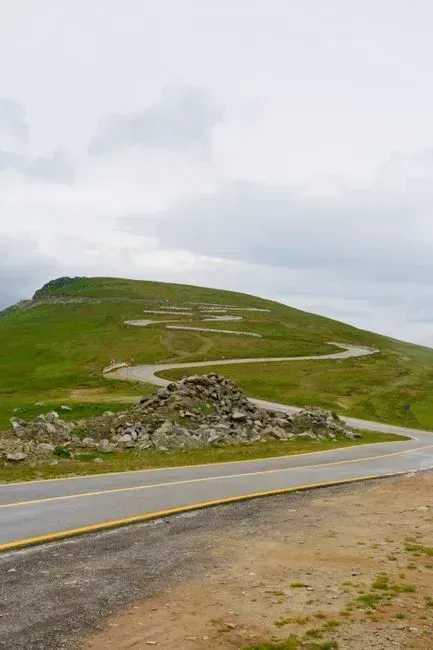
The Beartooth Highway links Red Lodge, Montana with Yellowstone’s northeast entrance across roughly 68 miles of the Absaroka and Beartooth mountain ranges. It is an All-American Road on a section of U.S. Route 212 between Red Lodge and the Northeast entrance of Yellowstone National Park, cresting at Beartooth Pass in Wyoming at 10,947 feet above sea level. A well known CBS correspondent once called it the most beautiful drive in America, a line that still gets repeated by travel writers decades later. Because of heavy snow at the summit, the pass is usually open for about five months per year, from mid-May to mid-October, weather conditions permitting.
The surrounding terrain is what makes this drive so unusual. It is one of the highest and most rugged areas in the lower 48 states, with 20 peaks reaching over 12,000 feet in elevation. Wildlife sightings are common along the corridor, and visitors can cross-country or downhill ski in June and July, hike across broad plateaus, and view and photograph wildlife including mountain goats, moose, elk, marmot, mule deer, black bear, grizzly bear, and wolf. Fewer than a handful of small services exist along the entire route, so most travelers fill up in Red Lodge before starting the climb.
2. Highland Scenic Highway, West Virginia
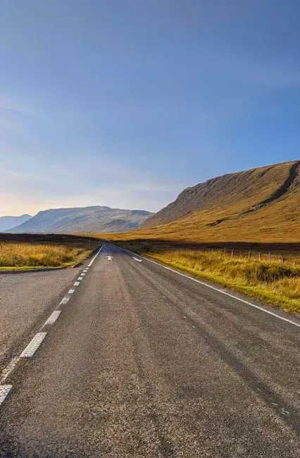
Tucked into Pocahontas County, the Highland Scenic Highway rarely comes up in national road trip lists despite sitting close to New River Gorge, one of the country’s newest national parks. From Beckley, drivers head two hours northeast to the Cranberry Glades, then travel north up the Highland Scenic Highway and drive through 43 miles of ridgeline filled with overlooks reaching 4,500 feet. The route feels remote almost immediately, with dense forest closing in on both sides of the road. It is a genuine mountain drive without the crowds typically associated with similar elevations out west.
One quirk worth knowing before setting out: there are no gas stations on the route, which to some is part of the appeal, so filling up beforehand is essential. Nearby, the New River itself adds another layer of interest, since it ranks among the oldest rivers on the continent and carves a gorge that rivals far more famous canyons. Lodging in the surrounding towns tends to run well below national park prices, which makes an overnight stop easy to justify. Travelers who plan around the fuel gap are rewarded with long stretches of empty ridgeline and almost no traffic.
3. Scenic Byway 12, Utah
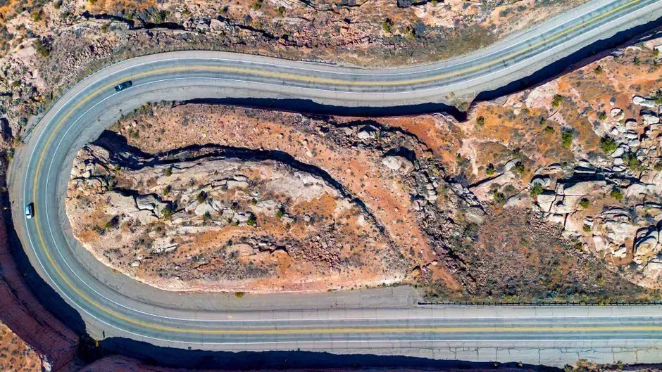
Utah’s five national parks get plenty of attention on their own, but the road connecting them deserves nearly as much credit. Scenic highways such as Utah State Route 12 connect several segments and are widely considered among the best drives in the American West. The route threads through red rock canyons, high desert plateaus, and small towns built around ranching long before tourism arrived. It is the kind of drive where the scenery between destinations often outshines the destinations themselves.
Travelers with a full week can attempt the entire loop, since driving the full loop is best experienced as a week-long trip. Those with less time gravitate toward shorter segments, and travelers with less time can focus on individual sections, such as Bryce Canyon to Moab, which combines red rock scenery with access to hiking and biking throughout. Because most attention goes to the parks bookending the route, the byway itself remains oddly overlooked, even by people who have already driven it once.
4. Natchez Trace Parkway, Tennessee and Mississippi
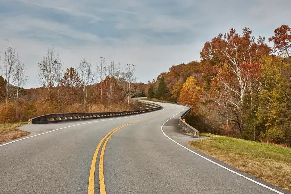
Stretching from Nashville down to Natchez, the Trace follows a path used by Native travelers, traders, and soldiers centuries before pavement existed. It is one of the nicest places to take a road trip to see the American South in all its glory, running by way of Tupelo, the birthplace of Elvis Presley, and offering easy access to archaeological sites, prehistoric ceremonial mounds, Civil War battlefields, and the original Native American trail. Unlike interstate alternatives, the parkway bans commercial trucking and billboards, which keeps the scenery uninterrupted for hundreds of miles.
Speed limits stay low throughout, encouraging a slower pace that suits the historical density of the route. Small towns along the way still function as working communities rather than tourist stops, giving the drive an authentic, unhurried feel. The parkway is free to enter and rarely requires reservations, a rarity for a National Park Service unit of this length. For a route that touches three states and centuries of American history, it draws surprisingly light traffic outside peak fall weekends.
5. Chief Joseph Scenic Byway, Wyoming
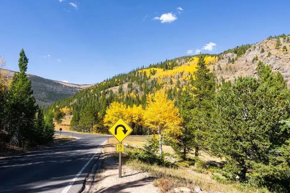
This 47-mile stretch connects to the Beartooth Highway yet somehow avoids most of the attention that its neighbor receives. Named for the chief of the Nez Perce tribe, who tried to stay one step ahead of the U.S. Cavalry, the byway crosses the Shoshone National Forest heading south from Beartooth Highway, ending just outside Cody, Wyoming, with highlights including views of the North Absaroka Mountains, Beartooth Mountains, and a transit of Dead Indian Pass. Many travelers who make it this far are already focused on reaching Yellowstone and skip the detour without realizing what they are missing.
Combined with Beartooth Highway and the Buffalo Bill Cody Scenic Byway, the three roads form a full day of driving through some of the most dramatic terrain in the Rockies. From Cody, it takes an hour to drive to the east entrance, and if travelers combine all three byways with the east entrance of Yellowstone, the full sequence takes one complete day. The historical thread running through the route, tied to Chief Joseph’s flight toward Canada, gives the scenery a weight that purely visual drives sometimes lack. It is a rare case where the story and the landscape carry equal importance.
6. North Shore Scenic Drive, Minnesota
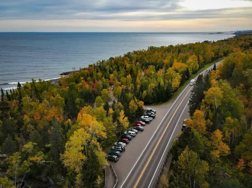
Lake Superior gets far less road trip attention than America’s coastlines, despite offering a similar sense of scale. The North Shore Scenic Drive is a 154-mile stretch along Lake Superior between Duluth and the Canadian border. The lake itself feels closer to an ocean than a lake once you’re driving alongside it, with waves, fog banks, and rocky shoreline that surprise first time visitors.
Waterfalls punctuate the route at a pace most drivers don’t expect from a Midwest drive. Highlights along the way include Gooseberry Falls, Split Rock Lighthouse, Tettegouche State Park, Temperance River State Park, Silver Bay, and Grand Marais. Duluth works well as a starting point, and it serves as the most logistical-friendly starting point, with the full loop around Lake Superior taking about 24 hours of driving time, making it best experienced as a week-long adventure. Shorter versions covering just the Minnesota shoreline are easy to complete in a long weekend.
7. Ponderosa Pine Scenic Byway, Idaho
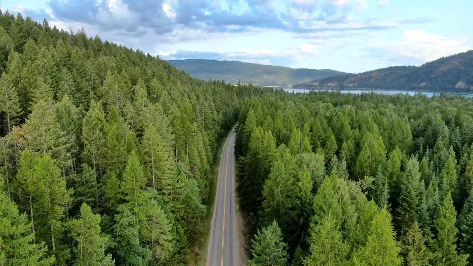
Idaho rarely tops anyone’s road trip wish list, which is exactly why this route feels like a discovery rather than a checklist item. The trip from Boise to Sun Valley along Idaho’s Ponderosa Pine Scenic Byway is packed with adventure, good food, and scenery, and although the drive only takes six hours, it’s worth taking a few days to explore the stops along the way. Pine forests, river canyons, and small mountain towns fill the gap between the two cities.
The standout stop along the way involves water rather than views. One can’t-miss spot is Kirkham Hot Springs, where visitors can stand under a waterfall that splashes them with 135-degree mineral water year round. Sun Valley itself offers a ski town atmosphere without the density of Colorado or Utah resort towns. The whole drive rewards a slower pace, since rushing through misses most of what makes it worthwhile.
8. Historic Columbia River Highway, Oregon
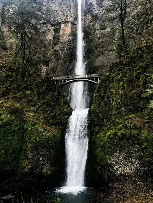
Long before modern scenic byways existed as a category, Oregon built one of the first. Oregon’s Historic Columbia River Highway is the first planned scenic highway in the United States, dating back to 1913. The route runs a modest distance yet packs in an unusual concentration of waterfalls and viewpoints. This 75-mile route begins in Troutdale, an eastern suburb of Portland, and ends in The Dalles, and can be explored in a day or extended into an overnight weekend trip.
Waterfalls are the headline feature here, and one in particular towers over the rest. Must-see features include numerous waterfalls such as Shepperd’s Dell Falls and the 620-foot-tall Multnomah Falls, along with scenic vistas like Chanticleer Point lookout and Crown Point. History buffs can also trace parts of the Lewis and Clark expedition along the same corridor. Given its proximity to Portland, it is surprising how many visitors skip it entirely in favor of longer coastal drives.
9. Highway 50 and Great Basin National Park, Nevada
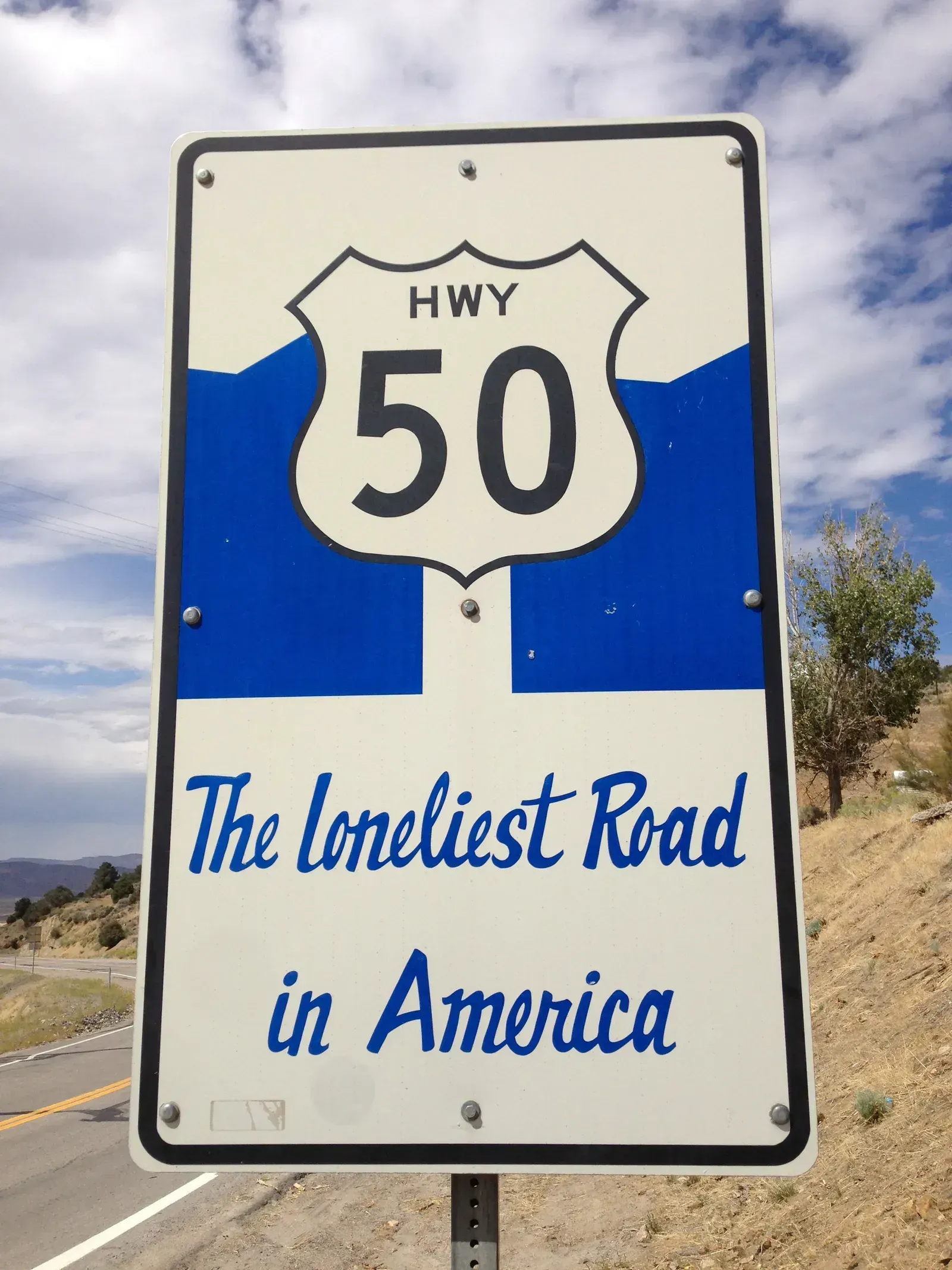
Nicknamed the Loneliest Road in America decades ago, this stretch of Highway 50 leads to one of the least visited national parks in the country. Great Basin National Park sits in White Pine County, Nevada, with the gateway town of Baker holding a population of approximately 68 people. The isolation is the point rather than a drawback, and drivers who commit to the route are rewarded with near total silence at every stop.
Inside the park, the terrain shifts dramatically within short distances. Great Basin National Park contains Lehman Caves, Wheeler Peak at 13,063 feet, and some of the darkest skies in the lower 48. Gas stations are sparse for long stretches, so fuel planning matters more here than almost anywhere else on this list. For travelers chasing true solitude, few American drives deliver it as reliably as this one.
Final thoughts





Leave a Reply